
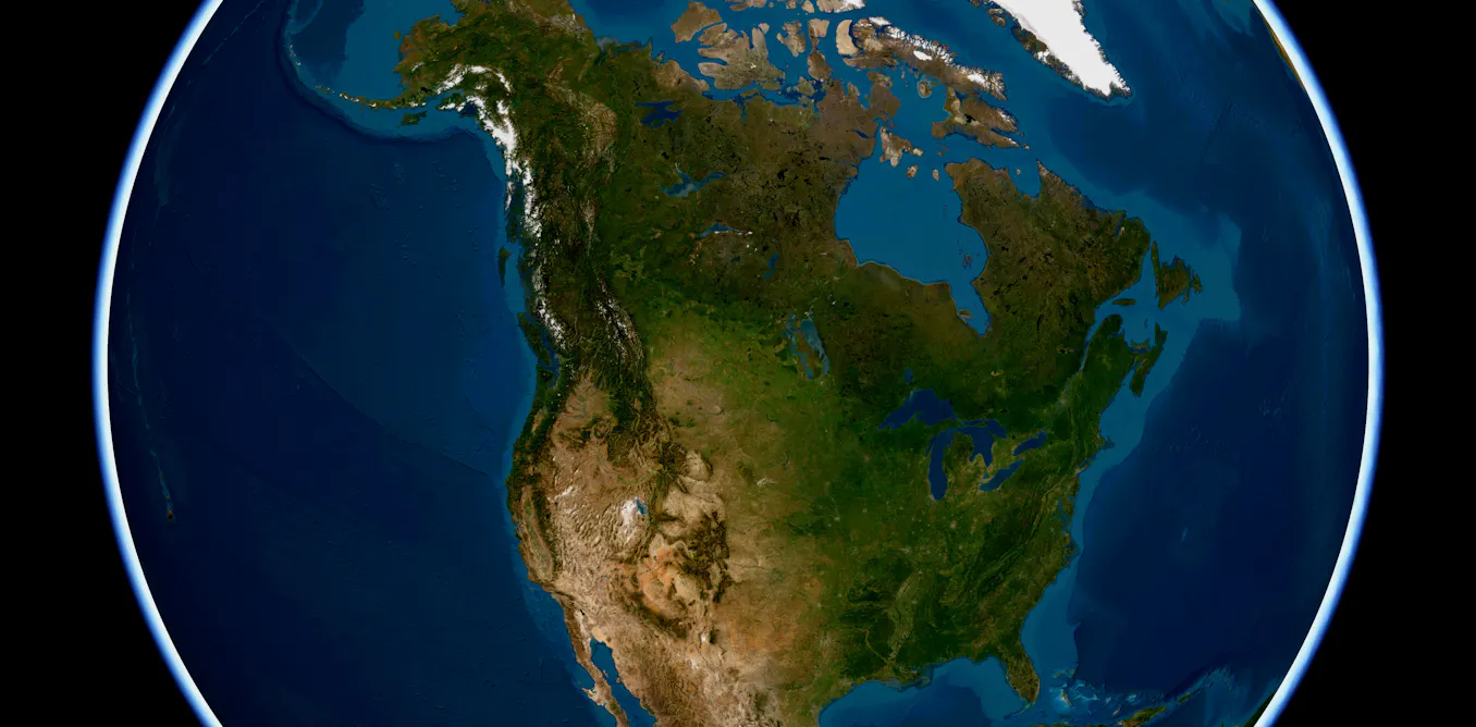
State lines fade when you study maps without state boundaries, a perspective that highlights how landforms, waters, wildlife and deep time connect the United States beyond political borders. Curators at the Smithsonian’s National Museum of Natural History say that lens animates their new exhibition, “From These Lands: Sharing Our Natural and Cultural Heritage,” created for the nation’s 250th anniversary and now open at the museum.
The show draws on collections to explore patterns across mountains, watersheds, migrations, biomes and long-vanished seas, inviting visitors to view the country’s natural and cultural heritage beyond state borders.
One country, many pine cones
Pine cones are easy to miss underfoot, yet their shapes carry clues about the trees that made them and the environments those trees inhabit. There are 43 pine species native to the U.S., nearly a third of global pine diversity, spanning a wide range of biomes defined by climate, terrain and associated plants and animals.
In the Southeast’s temperate evergreen forests, sand pine cones can stay sealed for years, opening only when heat from low-intensity fires melts their resin. Along the Pacific coast, the Coulter pine of Southern California’s Mediterranean Scrub grows cones that can exceed 50 centimeters in length and weigh up to 3.5 kilograms. Their size helps seeds endure fire, after which birds and small mammals disperse them. A single cone reflects soils, rainfall, fire and local wildlife, offering a handheld map of regional biomes across the U.S. and its territories.
An ancient ocean in the middle of the country
Rocks beneath the Great Plains and Badlands record a time when much of central North America lay under a warm, shallow sea. During the late Mesozoic Era, the Western Interior Seaway stretched from what is now North Dakota to Texas, depositing sediments that today form prominent outcrops across the region.
Fossils reveal a thriving marine ecosystem. Clams, snails and sea stars lived on the seafloor, while coiled ammonites, relatives of squid and octopuses, hunted in the water column alongside fish, turtles, sharks and plesiosaurs. Ammonites used chambered shells to regulate buoyancy, similar to the modern nautilus. Their remains confirm that an ancient ocean once covered the heart of the continent and underscore how landscapes are repeatedly reshaped over geologic time.
Unlikely pairing: Shorebirds and horseshoe crabs
Animal migrations can seem tangled on a map, yet they follow dependable rhythms tied to food and breeding. On the mid-Atlantic coast, the ruddy turnstone depends on a critical spring stopover at Delaware Bay during its long journey to Arctic breeding grounds.
The timing aligns with the shoreward migration of horseshoe crabs that lay millions of energy-rich eggs on sandy beaches. Turnstones refuel on these eggs before continuing north. The encounter between an ancient marine arthropod and a long-distance shorebird at a single bay shows how far-flung migrations hinge on specific places and moments.
Salamander country
Topography shapes where species live and how biodiversity accumulates. In the Appalachian Mountains, ridges, valleys, caves, ponds and cool, moist forests create a mosaic of habitats that differ by elevation, temperature, moisture and water flow.
The region hosts more salamander species than anywhere else on Earth. A trio within the genus Plethodon, known as the southern gray-cheeked, red-cheeked and red-legged salamanders, was once grouped as one species. They occupy different elevations and ranges, and genetic analyses confirmed each as distinct. Shifting climates and rugged terrain fragmented populations, fostering speciation across the mountains’ varied microhabitats.
Following the American shad
Chesapeake Bay, the nation’s largest estuary, is fed by a watershed spanning six states and the District of Columbia and supports more than 3,600 species. The American shad, a herring that spends most of its adult life in the Atlantic Ocean, returns each spring to freshwater rivers in the upper bay to spawn.
For more than 12,000 years, this migration has been central to the diet and culture of the Pamunkey Indian Tribe. To counter declines in herring, the tribe operated a hatchery from 1918 to 2019 to bolster stocks. The Pamunkey’s fishing rights trace to a 1677 treaty with the British Crown, and today only the Pamunkey and citizens of other Virginia tribes can legally harvest shad in the region. The fish’s path between saltwater and freshwater illustrates how watersheds link ecology with law, culture and stewardship.
Different ways to map the country without state boundaries
From pine cones and ammonites to shorebirds, salamanders and shad, these examples point to broader patterns: diverse forests, ancient seas, seasonal migrations, mountain microhabitats and rivers that knit landscapes together. Political borders are one way to view the nation. Natural history offers another, showing the enduring connections that run across the terrain when we look at maps without state boundaries.
The encounter between an ancient marine arthropod and a long-distance shorebird at a single bay shows how far-flung migrations hinge on specific places and moments, a theme echoed in research finding that more than half of migratory bird species are declining. State and federal wildlife agencies, including the U.S. Fish and Wildlife Service, increasingly factor these cross-border patterns into conservation planning.